One of the biggest perks of living in Springfield, Missouri is the abundance of trails and natural areas near the city. Serious hikers and afternoon strollers alike can find plenty of beautiful hiking trails near Springfield and even a few within the city itself. Springfield truly manages to incorporate the natural beauty of the Ozarks into city living.
Here are some of the hiking trails you can find near Springfield, Missouri:
Hiking Trails near Springfield, Missouri: South Creek Greenway: Located within the city of Springfield itself and recently named one of the National Park Service’s National Recreation Trails, the South Creek Greenway consists of over 8 miles of some of Springfield’s best walking. The route will take you through Springfield neighborhoods, as well as several parks and the Japanese stroll garden and, eventually, all the way to Wilson’s Creek Battlefield.
The trailhead for the South Creek Greenway is located at McDonald Park, on the corner of National and Sunset.
Hiking Trails near Springfield, Missouri: Frisco Highline Trail: If you are feeling adventurous, why not walk the Frisco Highline Trail from Springfield to Bolivar? Or, if the thought of a 35-mile hike doesn’t thrill you, you could walk to the towns of Willard (about 6 miles) or Walnut Grove (about 16 miles) instead. Any way you choose to walk the Frisco Highline Trail, it is worth it. Unlike the some of the other trails on this list, the Frisco Highline Trail is relatively smooth and flat (it’s covered with crushed gravel like Missouri’s most famous trail-the Katy Trail) and traverses open fields, woodlands and small towns, so you’re sure to find some variety.
The Frisco Highline Trailhead is located just west of US-160 on Kearney St. in Springfield.
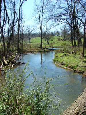
Hiking Trails near Springfield, Missouri: Busiek State Forest: For those looking to get further away from the city itself, you can’t go wrong with Busiek State Forest. With over 18 miles of trails that traverse the hills between Springfield and Branson, Busiek is plenty rugged and remote. In addition to woodlands, the state forest also boasts glades, streams, savannas and fields.
Busiek State Forest is located south of Springfield on Hwy. 65.
Hiking Trails near Springfield, Missouri: Ritter Springs Park and Sac River Trail: Ritter Springs Park and the Sac River Trail offer you a couple of options when it comes to hiking. If you are looking for a short stroll, you can walk around Ritter Springs Park’s large lake, or take one of the several short hiking trails into the nearby woods. If you want a more rugged trail (or are a mountain biker), check out the 8-mile Sac River Trail.
Sac River Trail and Ritter Springs Park are located on Hwy. 13 north of Springfield.
Hiking Trails near Springfield, Missouri: Springfield Conservation Nature Center: Maintained by the Missouri Department of Conservation, the Springfield Conservation Nature Center has several trails of varying lengths. You can hike all of the trails in just a few hours, so it’s the perfect place to spend an afternoon. After your hike, make sure you check out the Nature Center itself. They have plenty of interesting displays and a knowledgeable staff to answer any nature questions you have.
The Springfield Conservation Nature Center is located in Springfield just off James River Freeway (Hwy. 60), near Hwy. 65.
Sources:
Ozark Greenways
Frisco Highline Trail
Springfield Conservation Nature Center
Missouri Department of Conservation
Sac River Mountain Bike Trail
Metromix