Minnesota Historical Society has long been a recognized leader in making history accessible to the public. Other states are also stepping up to meet the challenge. Vermont announced on November 25, 2007, that it would make many 18th Century maps available in digital format from the state archives.
Picture men in woolen clothing hauling heavy boxes of chain and delicate transits over rugged terrain to create the survey maps which allowed the land to be divided for sale. Their careful and painstaking work often remains as the basis for land divisions today, yet the original records have been difficult to access, or even find.
Vermont State Archivist Gregory Sanford says, “Some of these records may be based on surveys and maps done 200 years ago, but they continue to have value, legal value and an informational value that has survived the centuries.” 1
Roads, boundary lines, and waterways are of interest to historians, the real estate industry, teachers, lawyers, and family genealogists. In many cases original markers may have moved or disappeared. Streams change course, trees die, marker stones may be lost. Providing access to the original maps is a great service to the public.
Although the maps in digital format can not serve as legal documents, they can be a good starting point for research, and make it much easier for someone to find where the actual map is physically located. Previously a researcher might have had to contact everyone from the state down to a town clerk to locate the map desired.
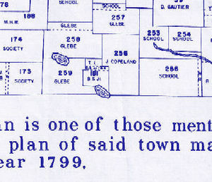
Vermont’s archival maps open as pdf files. They are searchable by the current name of a County or Town, or by the historic name at Vermont-Archives.org. Intriguing map names such as Chimney Point, or Missisquoi simply beg to be viewed. This interface is simple but usable.
Minnesota’s history does not reach back as far as the 1700’s but early maps have been placed on the Historical Society web site with a javascript tool which allows panning, zooming and other advanced mapping functions. Their archived mapping program begins at a section of the web site called True North: Mapping Minnesota’s History. True North begins with an opening splash video that is quite beautiful, but may be difficult for those with slow computers to use.
Minnesota has already moved to the next level of involving the public with history. It is creating a selection of online resource for use in schools. The web-based mapping tool will be combined with stories that geographic information can tell, a curriculum package for teachers, narratives created by students and teachers, and workshop resources for teachers. 2
Rapidly advancing technology has led to the loss of some records and information as formats and media changed and become obsolete. Archivists now see their role as that of managing records from when they are first created to preserve and make them retrievable by the public.
The technology of the future is ever bringing us into better touch with our past.
1. Quoted from “Vermont state archives puts 18th century survey maps online for landowners, surveyors”, MSNBC
2. “Geography and History Online: Integrating Digital Geographic Resources for Use in Schools”, Minnesota Historical Society.
")