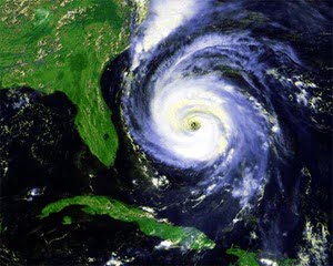
The 2007 Atlantic Hurricane season has yet to begin, but forecasters around the country are weighing in with predictions for the upcoming storm season. While an average Atlantic Hurricane season typically spawns around 11 named storms, only six usually become hurricanes, including two major hurricanes. However, as technology advances, academic researchers combined with a new computer model from the University of Miami Rosenstiel School of Marine & Atmospheric Science may give more insight into accurately predicting hurricanes before the beginning of the six-month-long season.
On May 22, experts at the National Oceanic and Atmospheric Administration presented its widely-known and respected hurricane forecast for the 2007 Atlantic Hurricane season. As the organization predicts an above-average season with 13-17 names storms total, it also expects 7-10 hurricanes and 3-5 major (at least Category 3) hurricanes. NOAA’s 2006 Hurricane season prediction proved to be a bust – an unexpected El Nino rapidly developed, leading to fewer tropical systems than NOAA had originally estimated. Even so, steering currents prevented most of the storms that did form from reaching land in the eastern United States.
According to the News & Observer, Gerry Bell, leading seasonal forecaster at NOAA, stated, “There is some uncertainty this year as to whether or not La Nina will form, and if it does how strong it will be… If La Nina develops, storm activity will likely be in the upper end of the predicted range, or perhaps even higher depending on how strong La Nina becomes. Even if La Nina does not develop, the conditions associated with the ongoing active hurricane era still favor an above-normal season.”
In April, North Carolina State University researchers released their own predictions. Estimating 12-14 named storms for this year’s hurricane season, NCSU scientists also predict 8-9 may become hurricanes, with 4-5 major hurricanes. Additionally, the group of researchers predicted 1-3 named storms affecting the southeastern United States coast, alone.
Dr. Lian Xie, professor of marine, earth, and atmospheric sciences at North Carolina State University, and graduate student Elinor Keith base their predictions on data from the last hundred years on Atlantic Ocean storm positions and strength, along with other information such as weather patterns and sea temperatures. Xie and Keith predict states along the Gulf of Mexico should be prepared for storm activity in 2007. Xie’s research signifies higher-than-average chances for 2-3 hurricanes forming in the Gulf, 1-2 of which may make landfall.
In 2006, North Carolina State University’s model was the only national model to accurately forecast the Atlantic Hurricane season. As NCSU predicted 5-6 hurricanes in the 2006 season, five hurricanes actually formed.
However, the 2007 Atlantic Hurricane season features another computational superpower to assist in accurate prediction of tropical systems. The Coupled Boundary Layer Air-Sea Transfer (CBLAST) computer model was developed and tested with the help of scientists at the University of Miami Rosenstiel School of Marine & Atmospheric Science. The state-of-the-art model uses data from NOAA’s Hurricane Hunter aircraft, along with buoy reports and underwater floats positioned before several recent hurricanes for developing its analyses.
“Measuring processes near the sea-surface in hurricanes is a challenge! The CBLAST field program which brought together many new ideas and techniques has provided a wealth of new data that will help us to improve our understanding of how hurricanes gain and lose energy,” stated Dr. William Drennan, associated professor of applied marine physics, in ScienceDaily.
Dr. Shuyi Chen, professor of meteorology and physical oceanography, and other scientists developed a high-resolution, atmosphere-wave-ocean model capable of forecasting hurricane eye-wall structures at around a 1-km resolution. The primary focus of the CBLAST-Hurricane program involves understanding the effects of air-sea interactions at the structure of hurricanes and the resulting intensity changes.
As one of the most all-inclusive studies ever on air-sea interaction, the new CBLAST-Hurricane program serves as the next generation in understanding and modeling hurricanes during the June 1 through November 30 Atlantic Hurricane season. Regardless of varying predictions and computer models, the 2005 Atlantic Hurricane season reinforced the need to study and better understand tropical systems, from formation to intensity variations to dissipation.