The new line of Magellan GPS units called Triton is out and I get to review two of them starting with the Triton 400, a great and easy to use handheld GPS unit with plenty of nice features in a basic unit.
Ease of Use/Performance: 23/25
Convenience/Storage 24/25
Appearance/Design 25/25
How much I enjoy 24/25
Total: 96/100
Magellan makes some good GPS products but in the past I have found some features that were a bit difficult to use and figure out. The new line of Magellan handheld GPS units called Triton solves many of these problems for a more user friendly GPS unit. The addition of a new software program that allows for a much easier interface and loading information to and from your GPS unit also makes using this new line of Triton’s a pleasure.
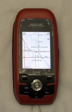
The Magellan Triton 400 is the first of the GPS units in the Triton line with an SD card slot instead of a fixed memory size. The Triton series comes with a nice color screen and built in base maps but the main features that make the units user friendly is the Vantage Point software for file loading and map work.
In case you are unfamiliar with GPS basics GPS stands for Global Positioning System and is a satellite system that is in orbit around the world for navigation and aviation. This system allows you to receive signals from these satellites for an accurate location by these handheld or even car mounted devices.
The WAAS system is the one maintain by North America and the EGNOS system is maintained by European countries but both are interchangeable and your GPS unit will probably not even care which signals it is receiving. GPS units receive signals from several satellites to give you an accurate positioning of the unit on the surface of the world. This triangulation is made more accurate by the use of more than three satellites and the better electronics of today’s technology also means more accuracy, quicker signal reception and more toys on the GPS units in a smaller package.
The Triton 400 costs about $200 and comes with the GPS unit, a USB cable for connectivity and the Vantage Point software. The Triton 400 has the regular GPS satellite receiver with WAAS/EGNOS reliability that gives you current position, speed and bearing. The Triton GPS has a nice odometer function as well as being able to record where the unit has been.
The tracking ability as well as being able to load points of interest and waypoints works easily with the included Vantage Point software that has built in base maps. The base maps included with the Vantage Point program are very basic and show major highways and interstates as well as major cities and large towns. If you want to use street maps or other kinds of specific maps that give some decent information you need to purchase some or download some free ones.
This is something that is part of owning just about every GPS unit I have seen and buying more software or programs is also a part of using a GPS. In order to have some decent maps at street level you will need to purchase one or use one you may have purchased in the past but there are also some very good free ones out there with a little searching.
Many forums such as Geocaching.com can be a great source for information on GPS units but one I found very helpful was not for geocaching or hiking but snowmobiling. A free map download at GPS Sled Maps that also shows trails snowmobilers use frequently has a great street map for use as a general street level base map. The Vantage Point software is also compatible with other software programs such as National Geographic’s TOPO, MapSend TOPO and even some other GPS companies software.
You will definitely want to purchase a Secure Digital card right away for use with your system as it does not have any memory without one. I loaded a snowmobile trail map from GPSSledMaps.com and had no problem easily uploading and viewing the very detailed, and free, map for Minnesota that has verified snowmobile trails marked.
Loading Geocaching coordinates works easily but not as LOC files but as waypoints, but it still works just as well. Geocaching is a treasure hunt that people hide small or even large containers all over the world and you go find them using a GPS unit. There are hundreds of thousands of these caches all over the place; I have a few dozen within walking distance of my home and hundreds you can drive to in under an hour. This is a fun way to spend some quality time outdoors getting some exercise and having fun by yourself or with friends and family, find out more at Geocaching.com.
You can individually input the information such as specific location and notes about points by hand from your computer or transfer them from previous versions. Using separate programs like Geocaching Swiss Army Knife is also very easy with the newest line of Triton GPS units and uploading geocaching location files is simple.
One thing that still has not been solved is being able to upload and display notes or hints for geocache locations so you will still need to take notes about each geocache if it has some and you think you may need them. The Vantage Point program does work a lot better than the previous version called Map Send Lite and Map Send Manager.
One other thing about geocaching with the Triton unit is that you need to have a paid subscription to the Geocaching website in order to download GPX files. The GPX files are the ones that contain all the geocache information in one file instead of just the latitude and longitude of the geocache.
The Triton 400 does a great job of tracking or tacking points of interest on the small and colorful screen and I had no problem using the GPS unit. The four direction rocker bar works very well to move the cursor on the screen as well as moving through the various menus.
Other software such as the National Geographic TOPO works just as well with the Triton 400 and I will be reviewing the TOPO program in a separate review very soon. The program loaded just fine and for the base TOPO maps and free program portion it worked just fine.
You can download several free additions to the TOPO program using the National Geographic site and program and the base program is free. Many of the free downloads available are popular tourist attractions like the Boundary Waters in Minnesota or trails of the Grand Canyon. These free additions to the TOPO maps are not the highly detailed close in features of the area but additions to the maps you purchase. For more information about the National Geographic TOPO please visit the National Geographic website or check back here or my own website for my review on the software package.
The actual design of the Triton 400 over the previous line of handheld GPS units is much better and more user friendly with the better controls on the unit. Navigating through the various pages, menus and sections is pretty simple and just picking up and using the GPS unit without much in the way of reading through pages of manuals or through websites is kept to a minimum.
Using the included Vantage Point software is also much easier than the previous version and is somewhat intuitive but you will have to do some reading to use the program. Loading base maps, waypoints for geocaching and even third party maps is very simple with a basic layout that is kept to a minimum of buttons on the pages.
This simple layout can be pretty easy to use but there are some things that may be a bit confusing if you don’t read about it before hand like not being able to load LOC files for geocaching information. Another slightly odd one is what they have termed Exchange, this is actually you’re upload and download buttons. Just a little different wording and once you find it there is no problem using the functions but they have done a pretty good job of keeping things simple despite these little idiosyncrasies.
Using the Magellan Triton 400 in the field, as it were, is fantastic and very fun, the GPS WAAS system finds satellites very quickly and is very accurate, up to 3 meters. This puts you very close to the actual location of things that are very accurately known like benchmarks. I checked out this accuracy and was only off a small amount for both the Triton 400 and the Triton 2000 I will also be reviewing.
The Triton 400 does a quick and easy job of finding where you are using not only the latitude and longitude with a good but basic base map you can also use the accurate compass and odometer. The odometer is a handy feature for measuring the distance you are traveling and the compass would be nice for hiking out in the great outdoors. You also get a speed of movement when you are walking or driving so there is plenty of regular GPS functions here that are common to many GPS units.
The compass is very accurate and I had no problem working with that as well as the pedometer for finding pretty accurate distances. I have a library that is one half mile from my home and the Triton showed this very well. I drove one day and the distance from the corner of my house to the parking lot just as you enter is pretty much one half mile, I also checked this with a mapping program on the internet as well. I checked this same distance with every handheld GPS I have reviewed and all of them agree that when I walk from the corner of my home to the same spot it is pretty much the same distance with all of them give or take a few feet.
The Triton 400 does a great job of simplifying the handheld GPS and making things like geocaching, finding your way on a hike, or even simple navigation like vacationing and finding that hotel much easier. You can enter tracks to help you find various locations on a computer and easily upload them to the GPS unit.
Magellan has listened to the complaints and suggestions of users and designed an easier to use and user friendly GPS unit and the Triton 400 is a reasonably priced and full featured unit. The Triton 400 does get really good marks from me and an almost award winning score as they have improved many points that I found were not exactly fantastic but still very good.
I highly recommend the Magellan Triton 400 for a good full featured handheld GPS unit for all your GPS needs. We’ll see how the higher priced model Triton 2000 stacks up to this model soon.